ESA – Earth Observation for Sustainable Development (EO4SD)
- Opdrachtgever
- ESA – European Space Agency
- Jaar
- 2016-2019
- Partners
- Eleaf, Satelligence, ITC, DHI-Gras, GeoVille, Space-Tec
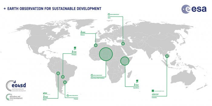
- Locatie
- Noord Afrika (Great Green Wall regio), Ethiopië, Burkina Faso, Uganda), Latijns Amerika (Bolivia, Paraguay en Uruguay), Azië (Cambodja) en het Midden Oosten (Syrië)
ESA launched the initiative: Earth Observation for Sustainable Development (EO4SD) in order to achieve the uptake of satellite-based environmental information in projects, programmes and activities of the Multilateral Development Banks and their client states. The EO4SD initiative concentrates on thematic areas: agriculture and rural development, water resources management, urban development, climate resilience, disaster risk reduction, marine resources, fragility, conflict and security.
The EO4SD Agriculture and Rural Development Cluster is represented by ESA and a consortium of eight organisations specialized in satellite data services, data integration, capacity building and communication. Over three years we demonstrated how earth observation-based information and services support agricultural monitoring and management tasks. We also trained the project’s stakeholders to use satellite imagery for their projects.
To facilitate the uptake of this technology within the International Financial Institutions, the EO4SD Agriculture and Rural Development Cluster demonstrated many of the benefits of EO-based geoinformation products and services. The demonstrations show how EO-based products and services support the entire project cycle of agricultural sustainable development projects.
De uitdaging
For Nelen & Schuurmans the task of Data Integrator presented a challenge considered the amount and diversity of the information to be shared. Posing the challenge of how to present the information in a comprehensible and integrative manner. The generated information during this project covered derived maps based on satellite information. Moreover, the information prepared for the stakeholders is the result of a combination of an analysis and models (e.g. deforestation, water productivity, habitat quality). The resolution of the data sets shared covered regions, such as the Sahara belt and specific countries, such as Cambodia. Therefore also the spatial resolution varied, from kilometers up to meters resolution.
For every demonstration the information has to presented, distributed and accessed by the users. The Lizard platform was deployed to host the richness of the information and thanks to its powerful connection via API, the access and transference was guaranteed.
Onze oplossing
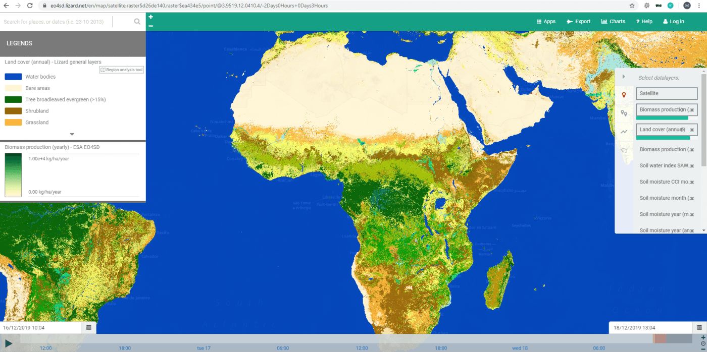
During the entire project all of the information and datasets were made accessible using the Lizard platform. We created a dedicated portal: eo4sd.lizard.net. For every one of the 15 demonstrations a sub portal was arranged. To provide an overview of the information we developed a catalogue. The catalogue makes it easy to view various sets of information and the necessary metadata for further update. It facilitates the search for specific countries, regions, data producer and product specifics. Furthermore, the needed metadata information is also available for every data sets in the catalogue.
Het resultaat
During these three years Lizard had more than 1000 visitors from different countries and regions. There were 200 personal accounts created and dedicated user manuals for every demonstration and used during the capacity building events. During every event, the stakeholders were guided to browse to the available data not only for their region but also for the others. Besides browsing through the data, the analytics of the platform was used in a way that the user could answer questions regarding to the presented results. Questions like: is the biomass increased or decreased in my project area during the last years?, or what is the influence of extreme weather to this trend in water productivity?
The datasets cover around 240 GB of information for the countries and regions at different spatial resolutions. To ensure the data remains available after the demonstrations, the datasets produced under EO4SD were shared with the following partners by using our API :
- World Bank: inclusion of 15 datasets including time series information in their data catalogue
- Conservation International: hosting of 55 datasets on the Resilience Atlas
- ICRAF: storing of 10 datasets including time series on the Landscape Portal
Go to the final report and video
Alle cases