3Di surface runoff modelling for Antwerp
- Client
- Stad Antwerpen
- Year
- 2022-2023
- Location
- Antwerpen
The city of Antwerp is committed to making the city more resilient to climate change induced weather extremes. Nelen & Schuurmans supports Antwerp by using the 3Di hydrodynamic modeling instrumentation to determine runoff lines and inundation created by rainwater runoff.
The challenge
The impact of climate change is compelling cities worldwide to adapt and prepare for more frequent and severe weather events. Antwerp is no exception, as it seeks to find solutions to potential flooding caused by extreme precipitation. One of the critical questions that the city needs to address is how rainfall runoff flows over streets and plots, and which areas are most at risk of flooding. By using runoff lines and mapping the locations of inundationafter heavy rainfall, the city can take proactive measures to prevent flooding by implementing above-ground solutions.
Our solution

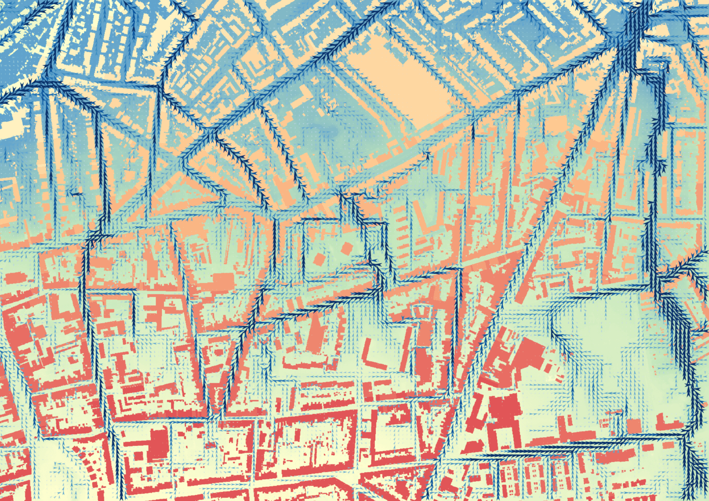
By utilizing the 3Di software, it is possible to generate a realistic runoff map that includes streamlines, upstream and downstream areas. This data is crucial in gaining insight into water flow patterns at both the neighborhood and street level. Furthermore, by providing the city with the inundation hotspots (including maximum water depths), the streamlines and the catchment areas, the city of Antwerp can accurately estimate the scope of necessary interventions to prevent flooding.
The outcome
In the end, we provided the city of Antwerp with interactive maps. This allows the local engineers to further investigate the inundation sources. To further aid this process we additionally provided the ‘watershed tool’. With the help of this tool, the city has the opportunity to determine the catchment area for each neighbourhood, street or lake and will use it to take targeted measures to become more resilient to climate change.
All cases