RESHAPE – Spatial Planning for Nature-Inspired Landscapes
- Client
- NWO
- Partners
- Vrije Universiteit Amsterdam, Utrecht University, Wageningen University & Research, HAS Green Academy
- Year
- 2024 - Ongoing
- Location
- The Netherlands
Towards resilient sand landscapes through water-driven spatial planning
More than half of the Netherlands consists of sandy landscapes that are increasingly vulnerable to drought, flooding, declining water quality, soil subsidence, and biodiversity loss.
Traditional water and land-use systems, designed for maximum agricultural efficiency under past climate conditions, no longer provide the resilience required for future climate extremes.
A key challenge is that water systems extend far beyond visible rivers and ditches: they include complex, often invisible flows through soil, vegetation, and groundwater.
Understanding and integrating these spatial dependencies into planning remains difficult, while they are essential for achieving a climate-resilient landscape.
The challenge
From sectoral optimization to integrated landscape transformation
Current planning practices often address water, agriculture, nature, and spatial development separately. This fragmented approach leads to trade-offs rather than synergies and limits the capacity to respond to climate change.
RESHAPE addresses this challenge by asking:
- How can spatial planning account for interconnected water systems across scales?
- Which nature-inspired strategies can restore resilience in sandy landscapes?
- How can trade-offs between ecosystem services be made explicit and actionable?
Our solution
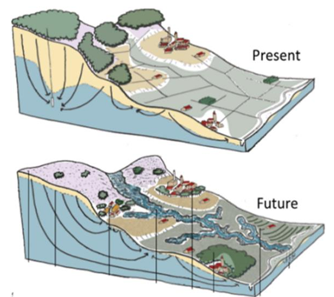
A spatial planning framework based on Nature-Inspired Principles
Within RESHAPE, we develop a data-driven and design-oriented spatial planning approach that integrates hydrology, ecology, and socio-economic considerations. At the core of the approach is the use of Nature-Inspired Principles (NIPs) to guide landscape transformation.These principles include:
- Reconnect water and soil systems
- Restore natural buffering and retention capacity
- Align land use with the underlying physical system
In RESHAPE we combine:
- Hydrological and ecohydrological models (WP1)
- Ecosystem service assessments and trade-off analysis (WP2)
- Spatial planning tools and design scenarios (WP3)
- Resilience evaluation of proposed interventions (WP4)
This integration enables the development of spatially explicit scenarios for future-proof landscapes.
For more information on RESHAPE and the partners within the project, consult the RESHAPE website.
Image source: A nature-based future for the Netherlands in 2120 (M. Baptist et al., 2019). Wageningen University & Research (https://doi.org/10.18174/512277)