Features
Flood forecasting and early warning systems are a key flood risk management measure for preparedness against floods and increased resilience.
With our FloodSmart solution services we aim to let no one be surprised by a flood. Together with our global partner network we actively support communities around the globe to be better prepared when floods arise.
-
System updates
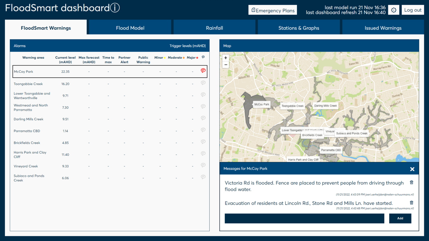
FloodSmart informs you on the date and time of the last flood forecast model run and the latest dashboard refresh. The dashboard automatically refreshes every 5 minutes to ensure the latest insights are used in the emergency response
-
List critical locations
Choose critical locations in your flood prone area to set warnings and receive vital information about the emerging flood such as the current water level, maximum forecasted water level, the time left until maximum water levels are forecasted, the thresholds set for warnings and if these thresholds are forecasted to be breached
-
Map
Share warning areas and critical locations on the map. Warning areas where water levels are forecasted to breach warning thresholds are highlighted with the corresponding color.
-
Messages
Let emergency response teams share information from the ground with forecasting specialists in the emergency coordination center and vice versa.
Warnings
List and visualize warning areas and critical locations.
-
Buildings and roads
Integrate data on buildings and roads to see which buildings are expected to flood and which roads are expected to be inaccessible.
-
Flood risk maps
Compare data from you flood risk assessments with the flood forecasts for reference
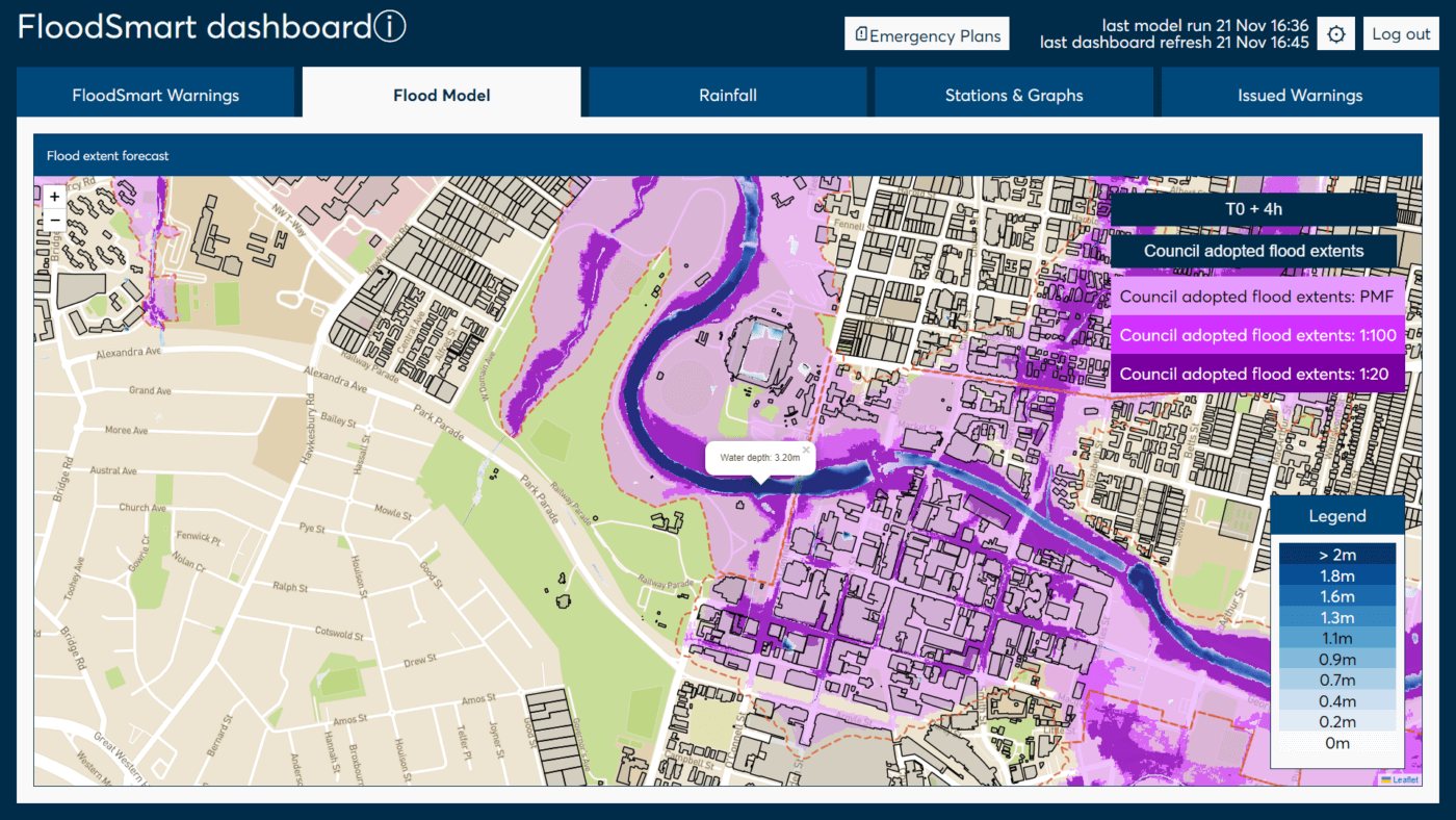
Flood model
The flood model provides insights in the forecasted flood extent and depth of the flood waters at multiple moments from now. You can also obtain the water depth on specific locations by clicking on the map.
-
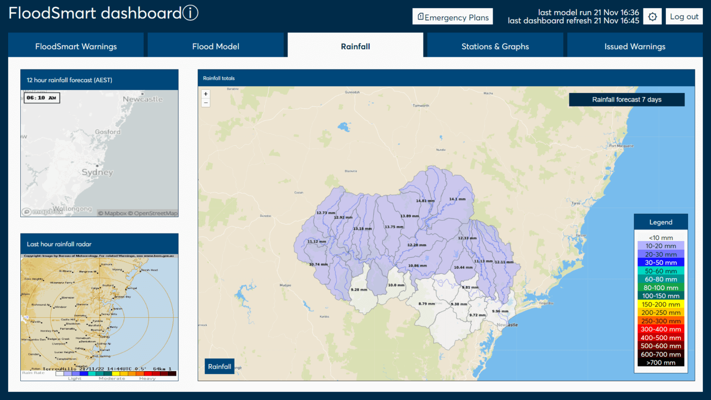
Gauges & Radar
FloodSmart provides insights in the observed rainfall in your catchment. These observations come from radar and gauge stations in your catchment.
-
Rainfall forecast
FloodSmart provides insights in the forecasted rainfall at various moments in the future. The rainfall is aggregated to sub-catchment level to give you more insight in how much and where rain will fall in your catchment. On the map sub-catchments are colored to corresponding warning levels
-
Rainfall statistics
Provide rainfall statistics for reference
Rainfall
FloodSmart provides insights in the forecasted rainfall at various moments in the future.
-
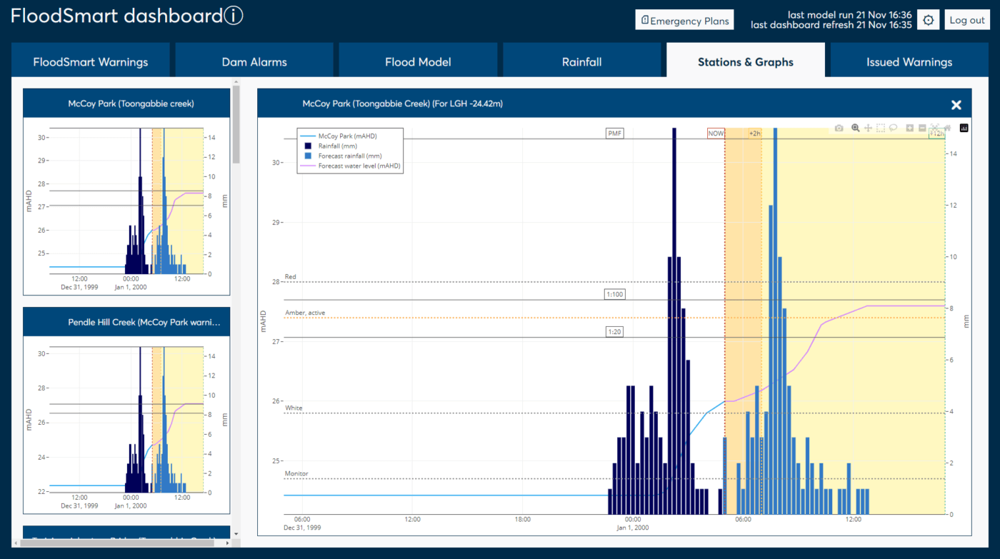
Detailed graphs
The graph combines observed and forecasted water levels & rainfall. Corresponding warning thresholds are shown in the graph.
Stations & graphs
For each critical location, a detailed graph is provided.
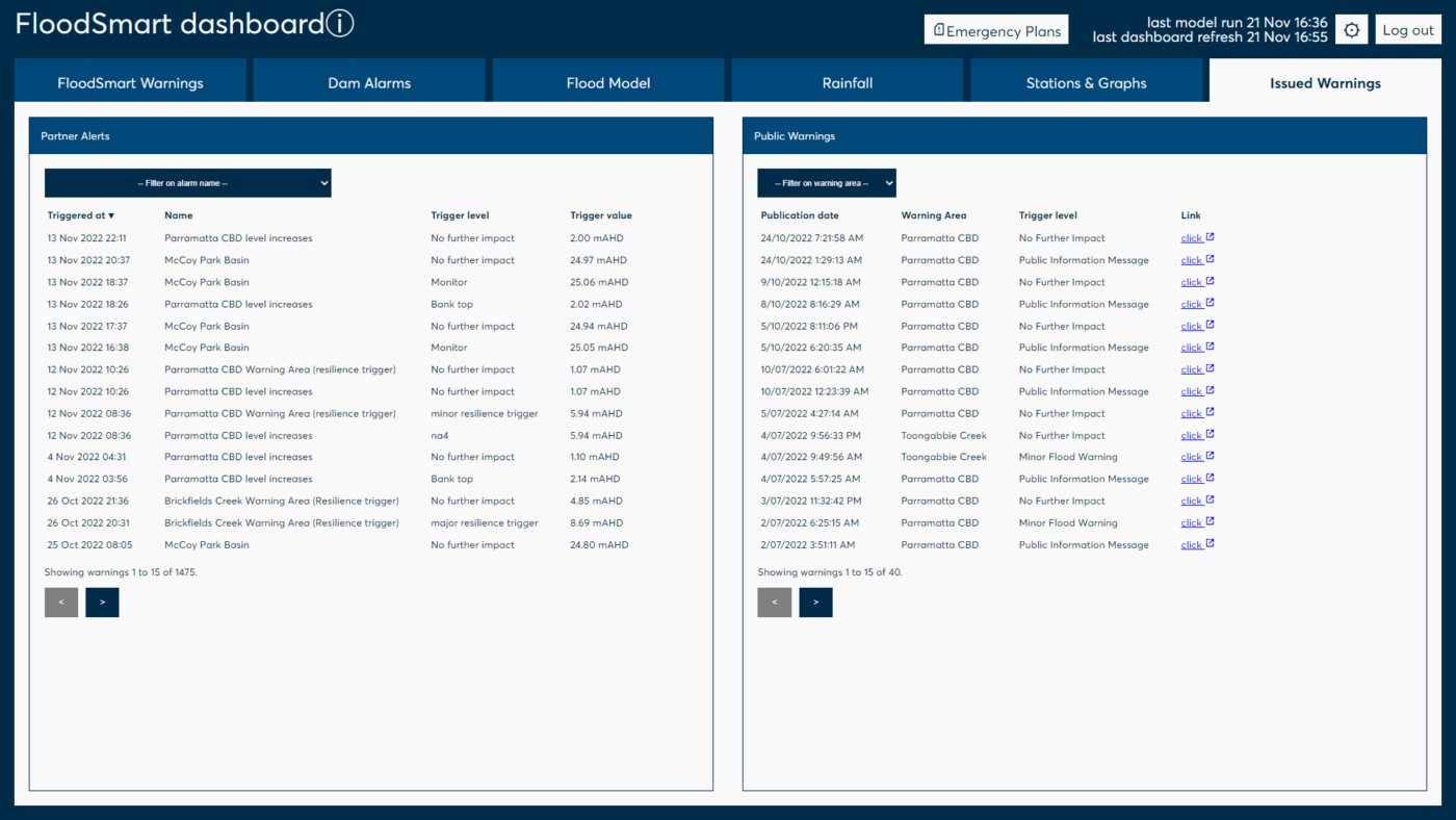
Issued warnings
To keep overview of issued warnings, the system lists all issued warnings and their corresponding thresholds levels and trigger levels. FloodSmart allows you to send warnings to various groups in various stages of flood response process.
Warnings can be send via SMS and e-mail. People can easily be added to contact groups.