Angkor SALAD: Information service for Cambodian farmers
- Client
- ICCO
- Partners
- Angkor Green, ICCO, VanderSat, Akvo, World Vegetable Center, General Directorate of Agriculture
- Year
- 2018
- Location
- Cambodja
The Angkor SALAD project provides geodata based information services to over 100.000 vegetable farmers and agribusinesses in Cambodia. The project focuses on irrigation and fertilizer advice, with additionally crop planning recommendations, marketing information and Khmer GAP compliance instructions.
“Nelen & Schuurmans helps us to make agricultural advisory services to smallholder farmers time- and location specific. With their experience and the Lizard platform, they have been a great partner in the SALAD project” – Lenneke Braam, Regional Director ICCO South East Asia
The challenge
Smallholder farmers and agribusiness in Cambodia don’t have access to real-time spatial information in their daily practices. Vegetable cultivation can hugely benefit from accurate data, weather forecasts, and soil conditions in relation to the current crop conditions. When the complex geodata is translated into actionable advice, it will improve vegetable production and the livelihoods of smallholders at the same time.
Our solution

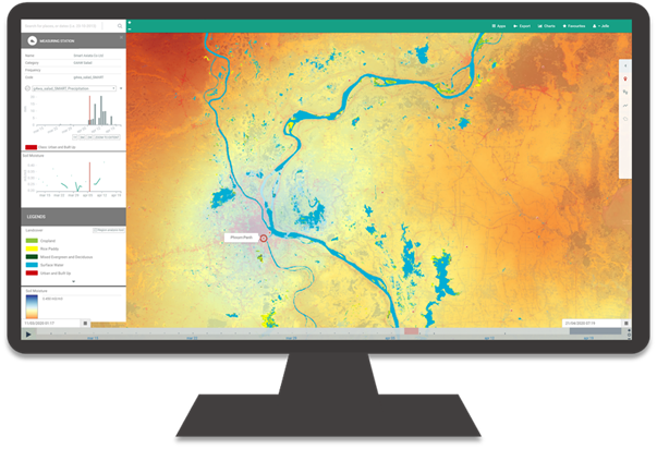
The SALAD team has built a state-of-the-art information service, based upon the Lizard data warehouse and analytics platform. Various data sources are combined and integrated, including satellite images and observations from the field. This provides accurate data on weather, climate, soil moisture, soil nutrients and plant conditions. In the Lizard platform multiple algorithms are used to create agricultural advises on plot level. Farmers use the SALAD smartphone app to access the advice. Next to the information to farmers we offer dashboarding solutions to relevant value chain actors.
The outcome
We provide insight on sustainable water use and irrigation advice in SALAD, and facilitate agricultural advisory services in Lizard. In Cambodia, the SALAD smartphone app and dashboards provide easy to use interfaces that are tailor made to the local conditions. This way, we can truly provide actionable advice to various end-users, and help them with answering questions as:
- What is the soil moisture conditions and how much should I irrigate?
- What is the water availability in various regions?
- How much fertilizer should be applied?
- What is the most suitable time to plant a specific vegetable?